e99 Online Shopping Mall

Geometry.Net - the online learning center Help  
Home  - Basic V - Virginia Maps (Books)

  Back | 61-80 of 105 | Next 20
A  B  C  D  E  F  G  H  I  J  K  L  M  N  O  P  Q  R  S  T  U  V  W  X  Y  Z  

click price to see details     click image to enlarge     click link to go to the store

61. ADC the Map People Loudoun County,
62. Northern Virginia Atlas (Adc the
 
63. Virginia Valley records: Genealogical
 
64. JOHN SMITH'S MAP OF VIRGINIA WITH
$8.98
65. Shenandoah National Park, VA -
$10.15
66. Staunton/Shenandoah Mountain,
$4.95
67. Charlottesville, Virginia: Includes:
68. ADCS Street Atlas Albemarle County,
69. ADC the Map People 2007 Northern
 
$4.99
70. Street map, Staunton, Waynesboro,
$19.35
71. ADC The Map People Virginia Peninsula
$34.00
72. Virginia Cruising Guide 2010-2011
 
73. Historical Atlas of Westmoreland
 
$109.99
74. Atlas of County Boundary Changes
$11.69
75. Adc the Map People Fauquier County,
$15.74
76. History of the Settlement and
$6.58
77. Richmond VA Street Map
78. Virginia in Maps: Four Centuries
79. South Hampton Roads VA Atlas (South
$125.86
80. American Map Virginia State Road

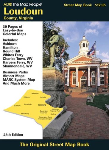
61. ADC the Map People Loudoun County, Va Street Map Book (Loudoun County Va Atlas)
by the Map People ADC
Map: Pages (2005-10-15)
list price: US$12.95
Isbn: 0875307264
Canada | United Kingdom | Germany | France | Japan
Editorial Review

Product Description
Large scale atlas with street level detail showing ZIP Codes, block numbers, airports, shopping centers, points of interest, schools, hospitals, parks and much more. Fully indexed. Includes Leesbrug, Middleburg, Sterling Park and Washington Dulles International Airport. ... Read more


62. Northern Virginia Atlas (Adc the Map People Northern Virginia)
by ADC The Map People
Paperback: 120 Pages (2008-11-19)
list price: US$14.99
Isbn: 087530771X
Canada | United Kingdom | Germany | France | Japan

63. Virginia Valley records: Genealogical and historical materials of Rockingham County, Virginia, and related regions (with map)
by John Walter Wayland
 Hardcover: 491 Pages (1978)

Asin: B0006WUFE8
Canada | United Kingdom | Germany | France | Japan
Editorial Review

Product Description
This volume is largely a sourcebook of genealogical and historical materialscompiled from public records of the counties of Rockingham, Augusta, Greenbrier, Wythe, andMontgomery. Contents include Rockingham Marriages, 1795-1825; Rockingham Landowners,1789; Augusta County Church Records, 1756-1844; Men in Service Against the Indians, 1774;Rockingham Militia, 1788; Early Settlers in East Rockingham; Extracts from Augusta CourtRecords; and Rockingham Wills. The book also includes sketches of a number of families in thearea, among them Bowman, Cassell, Connelly, Craig, Custer, Harnsberger, Hooke, Keesling,Kemper, Kisling, Laird, Miller, Simmern, Sourwine, Spence, and Walker. ... Read more


64. JOHN SMITH'S MAP OF VIRGINIA WITH A BRIEF ACCOUNT OF ITS HISTORY Jamestown 350th Anniversary Historical Booklet Number 3
by Ben C. McCary
 Paperback: Pages (1957)

Asin: B001CJDJ0Q
Canada | United Kingdom | Germany | France | Japan

65. Shenandoah National Park, VA - Trails Illustrated Map #228 (National Geographic Maps: Trails Illustrated)
by National Geographic Maps
Map: Pages (2007-08-01)
list price: US$11.95 -- used & new: US$8.98
(price subject to change: see help)
Asin: 1566953650
Average Customer Review: 4.5 out of 5 stars
Canada | United Kingdom | Germany | France | Japan
Editorial Review

Product Description
The map includes Shenandoah National Park in its entirety, wilderness areas, Rapidian Wildlife Management Area, Overall Run Waterfall, Whiteoak Canyon Waterfall, Cedar Run Waterfall, Rose River Waterfall, Dark Hollow Waterfall, Lewis Waterfall, South River Waterfall, Doyles River Waterfalls #1 and #1, Jones Run Waterfall, the citis of Front Royal, Waynesboro, Harrisonburg, Shenandoah, Elkton, Grottoes,and Charlottesville, George Washington National Forest, the Appalachian Trail, Shenandoah River, Skyline Drive, and much more. Includes UTM grids for use with your GPS unit.


Scale = 1:75,000 Size 26'' x 38'' ... Read more

Customer Reviews (6)

4-0 out of 5 stars good map
I used this map as a guide when my friend and i went on am 4 day backpacking trip from Fontana to Waterville on the AT(about 70mi). This map is very helpful in that it tells you where everything is, but be mindful when using the elevation profile. It can be misleading between the peaks.

5-0 out of 5 stars Great!
Very accurate map of the trails in Acadia.It made it easy to change our hike halfway through and try out new trails on a whim.

5-0 out of 5 stars Great Map
This is a great map that gives you an excellent overview of all the trails in the Smoky Mountains.Put it in your backpack and you're set.

4-0 out of 5 stars Excellent Series of Maps
These Natl Geo maps are incredible! They may be a little pricey and they aren't quite as water-resistant as they claim to be, but the general aesthetic qualities of these maps are squarely better than anything else on the market...including the maps contained within the ADK Trail Guide series -no offense to anybody. The reason why I say this is because these maps coincide with the previously mentioned "Trail Guide" series, so the trail numbers (along with a bunch more information all in full color) are on these maps as well.

I get mine laminated with a super-thin laminate and keep them rolled up in a wicker basket...just to prevent wear and tear along creases and whatnot.

5-0 out of 5 stars great product
They are very weatherproof. Mine has been through a lot and it is still in pretty good condition. I always take it on my frequent GSMNP hikes. It's very detailed and the trail distances seem to be right on. I highly recommend it to anyone who plans on hiking the Smokies. ... Read more


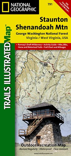
66. Staunton/Shenandoah Mountain, George Washington National Forest Hiking Map
by Trails Illustrated Maps
Map: Pages (2009-04)
list price: US$11.95 -- used & new: US$10.15
(price subject to change: see help)
Asin: 156695374X
Canada | United Kingdom | Germany | France | Japan

67. Charlottesville, Virginia: Includes: University of Virginia Map, Monticello Map, Regional Map
Map: Pages (2006-07)
list price: US$4.95 -- used & new: US$4.95
(price subject to change: see help)
Asin: 0875307922
Canada | United Kingdom | Germany | France | Japan
Editorial Review

Product Description
Convenient folding map with street level detail of the city of Charlottesville. Includes ZIP Codes, block numbers, parks and more. Enlargement of the University of Virginia area is shown. ... Read more


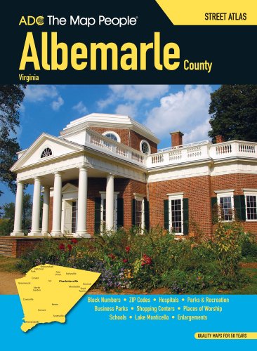
68. ADCS Street Atlas Albemarle County, Virginia
by the Map People ADC
Paperback: 68 Pages (1991-06)
list price: US$11.95
Isbn: 0875300316
Canada | United Kingdom | Germany | France | Japan
Editorial Review

Product Description
Large scale atlas with street level detail showing ZIP Codes, block numbers, schools, hospitals, shopping centers, points of interest, airports, parks and much more. Fully indexed. Includes Charlottesville, Crozet, Earlysville and Monticello. Enlargement of the University of Virginia is shown. ... Read more


69. ADC the Map People 2007 Northern Virginia Street Map Book (Adc the Map People Northern Virginia)
Paperback: 120 Pages (2007-05-15)
list price: US$12.95
Isbn: 0875308325
Canada | United Kingdom | Germany | France | Japan

70. Street map, Staunton, Waynesboro, Augusta County, Virginia: Includes Fisherville, Stuarts Draft, Verona
by Inc Map Supply
 Unknown Binding: Pages (1997)
-- used & new: US$4.99
(price subject to change: see help)
Asin: 1573961981
Canada | United Kingdom | Germany | France | Japan

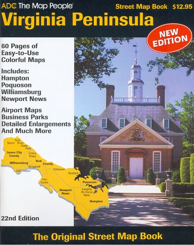
71. ADC The Map People Virginia Peninsula Street Map Book
by ADC the Map People
Paperback: 84 Pages (2005-08-30)
list price: US$12.95 -- used & new: US$19.35
(price subject to change: see help)
Asin: 0875306888
Canada | United Kingdom | Germany | France | Japan
Editorial Review

Product Description
Large scale atlas with street level detail showing ZIP Codes, block numbers, airports, points of interest, shopping centers, schools, parks and more. Includes James City County, York County and the cities of Williamsburg, Newport News, Hampton and Poquoson. Fully indexed. ... Read more


72. Virginia Cruising Guide 2010-2011
by Williams & Heintz Map Corporation
Map: 64 Pages (2010-01-01)
list price: US$34.00 -- used & new: US$34.00
(price subject to change: see help)
Asin: 0967846730
Canada | United Kingdom | Germany | France | Japan
Editorial Review

Product Description
Plot your course with a Williams & Heintz cruising guide! Based on NOAA's NAD-83 charts, our guides contain the latest information about buoys, marinas, ramps and other marine facilities.

Each book is enclosed in a heavy-duty vinyl case to protect it from spray. The pages are printed on high wet strength paper. This paper is just as strong wet as dry. One of the lowest priced boating guides available!!

ORDER HERE!
'The charts in this guide are reproductions of selected NOAA charts. Charts 1 through 21 are at a scale of 1:80,000. The insets are in various scales from 1:40,000 to 1:20,000. The charts were corrected utilizing the information published in the U.S. Coast Guard Local Notice to Mariners through February 2008.'
Williams and Heintz printed the very first Guide for Cruising Maryland Waters beginning in the early 1960's for the Department of Natural Resources. Now, new and improved, it is published under the title of Maryland Cruising Guide. This is a complete marine atlas of tidal waters, including over 50 insets of rivers and harbors.
This Chart book is the successor to the Maryland Cruising Guide. The same standards of accuracy and quality are continued in the Virginia Cruising Guide.

CHART INDEX & CHART NUMBER:

1-Norfolk and Routes South
2-Atlantic Shore (Virginia Beach to Back Bay)
3-Western Shore (York River Entrance to Norfolk)
4-Chesapeake Bay Entrance
5-Western Shore (York River to Rappahannock River)
6-Eastern Shore (Cape Charles to Occohannock Creek)
7-Western Shore (Rappahannock River to Smith Point)
8-Mid-Bay (Windmill Point to Smith Point and Tangier Island)
9-Eastern Shore (Tangier Sound and Pocomoke Sound)
10-Eastern Shore (Smith Island and Pocomoke Sound)
11-Potomac River Entrance
12-Potomac River (St. George Island to Breton Bay)
13-Potomac River (Colton Point to Mathias Point)
14-Potomac River (Mathias Point to Gunston Cove)
15-Potomac River (Mattawoman Creek to Washington D.C.)
16-Atlantic Shore (Cape Charles to Great Machipongo Inlet)
17-Atlantic Shore (Quinby Inlet to Metompkin Inlet)
18-Atlantic Shore (Garathy Inlet to Chincoteague Island)
19-Atlantic Shore (Chincoteague Island to Ocean City Inlet)
20-Atlantic Shore (Chincoteague and Oceant City Inlet)
21-James River (Nansemond River to Warwick River)
22-James River (Jamestown Island to Seven Mile Reach)
23-James River (Seven Mile Reach to Richmond)
24-York River (Yorktown to West Point -Mattaponi & Pamunkey Rivers)
25-Rappahannock River(Corrotoman River to Horse Head Point)
26-Rappahannock River (Horse Head Point to Fredericksburg)
... Read more


73. Historical Atlas of Westmoreland County, Virginia: Patents, showing how lands were patented from the crown & proprietors of the Northern neck of Virginia...portraits, maps, airplane views & other data
by David Wolfe Eaton
 Hardcover: 79 Pages (1942)

Asin: B0007DWAA8
Canada | United Kingdom | Germany | France | Japan

74. Atlas of County Boundary Changes in Virginia, 1634-1895
by Michael F. Doran
 Paperback: 61 Pages (1987-06)
list price: US$20.00 -- used & new: US$109.99
(price subject to change: see help)
Asin: 0935931309
Canada | United Kingdom | Germany | France | Japan

75. Adc the Map People Fauquier County, Virginia Street Atlas
Paperback: 88 Pages (2008-12-03)
list price: US$14.99 -- used & new: US$11.69
(price subject to change: see help)
Asin: 087530835X
Canada | United Kingdom | Germany | France | Japan

76. History of the Settlement and Indian Wars of Tazewell County, Virginia; With a Map, Statistical Tables, and Illustrations
by George W. L. Bickley
Paperback: 116 Pages (2010-10-14)
list price: US$16.96 -- used & new: US$15.74
(price subject to change: see help)
Asin: 0217007147
Canada | United Kingdom | Germany | France | Japan
Editorial Review

Product Description
This is an OCR edition without illustrations or index. It may have numerous typos or missing text. However, purchasers can download a free scanned copy of the original rare book from GeneralBooksClub.com. You can also preview excerpts from the book there. Purchasers are also entitled to a free trial membership in the General Books Club where they can select from more than a million books without charge. Original Published by: Morgan & Co. in 1852 in 283 pages; Subjects: Indians of North America; Tazewell County (Va.); Tazewell Couty (Va.); History / Native American; History / United States / General; History / United States / State & Local / General; History / United States / Colonial Period (1600-1775); History / United States / State & Local / South; Social Science / Ethnic Studies / Native American Studies; ... Read more


77. Richmond VA Street Map
by ADC The Map People
Map: Pages (2009-07-15)
list price: US$4.99 -- used & new: US$6.58
(price subject to change: see help)
Asin: 0841671079
Canada | United Kingdom | Germany | France | Japan

78. Virginia in Maps: Four Centuries of Settlement, Growth, and Development
Hardcover: 337 Pages (2000-06-30)
list price: US$90.00
Isbn: 0884901912
Average Customer Review: 5.0 out of 5 stars
Canada | United Kingdom | Germany | France | Japan
Editorial Review

Product Description
Virginia's long and rich history is documented by thousands of maps that trace the discovery, settlement, expansion, and growth of the commonwealth, yet no comprehensive atlas of the entire state has ever been published. Virginia in Maps fills that void, providing access to more than 200 color images of the most important maps of the colony and of the state in a single, large-format volume. The atlas's five essays by leading cartographic scholars will make it an essential reference and educational tool. ... Read more

Customer Reviews (1)

5-0 out of 5 stars Stunning Collection of Historical maps
I highly recommend this book for anyone who loves historical maps. The collection spans nearly the entire history of the Old Dominion. The maps are beautifully reproduced with discernible detail that one can spend hours poring over. The accompanying text provides the historical context and background for the included maps. The book leaves one yearning for more. Would that all states had a book of this type available! ... Read more


79. South Hampton Roads VA Atlas (South Hampton Roads, Virginia Street Map Book)
by ADC The Map People
Paperback: 112 Pages (2009-07-15)
list price: US$14.99
Isbn: 0841671087
Canada | United Kingdom | Germany | France | Japan

80. American Map Virginia State Road Atlas
Paperback: 144 Pages (2008-01-30)
list price: US$16.95 -- used & new: US$125.86
(price subject to change: see help)
Asin: 087530172X
Canada | United Kingdom | Germany | France | Japan

  Back | 61-80 of 105 | Next 20
A  B  C  D  E  F  G  H  I  J  K  L  M  N  O  P  Q  R  S  T  U  V  W  X  Y  Z  

Prices listed on this site are subject to change without notice.
Questions on ordering or shipping? click here for help.

site stats