- United States Classic Wall Map- Enlarged & Laminated by National Geographic Society, 2006-01-01
- US Rolled Map (M Series World Wall Maps) by Rand McNally and Company, 2008-01
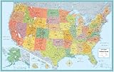
- United States Executive Wall Map - Laminated by National Geographic Maps, 2006-01-01
- Rand McNally Kids Illustrated Wall Map of the US by Rand McNally and Company, 2009-05
- US College & University Reference Map: Over 1300 top colleges in the US and Canada by Hedberg Maps Inc., 2006-01-01
- Illustrated map of the US for kids (Laminated Children's Wall Map of the US for Kids) [Map]) by Akros, 2010-10-20
- US ROAD ATLAS 2011 STANDARD (United States Road Atlas Including Canada and Mexico) by AMERICAN MAP COMPANY, 2010-05-10
- Children's map of the United States (Laminated Illustrated Wall Map of the US for Kids) by Akros, 2010-03-15
- MAP READING AND LAND NAVIGATION, U.S. Army, FM 3-25.26, FM 21-26, Military Manuals, Survival Ebooks by US Army www.survivalebooks.com, 2001-07-20
- US/World Rolled Map Combo-40 x 28 - Laminated by UniversalMap, 2009-08-01
- AMC US/Canada/Mexico Road Atlas 2004 (United States Road Atlas Including Canada and Mexico)
- Virgin Islands: US & British - Road Map
- Things Maps Don't Tell Us: An Adventure into Map Interpretation by Armin K. Lobeck, 1993-06-01
- United States Executive Wall Map- Enlarged & Laminated by National Geographic Maps, 2006-01-01
|