e99 Online Shopping Mall

Geometry.Net - the online learning center Help  
Home  - Basic H - Historical Maps (Books)

  1-20 of 100 | Next 20
A  B  C  D  E  F  G  H  I  J  K  L  M  N  O  P  Q  R  S  T  U  V  W  X  Y  Z  

click price to see details     click image to enlarge     click link to go to the store

$38.76
1. The Maryland State Archives Atlas
$19.31
2. The Image of the World: 20 Centuries
$5.42
3. Ancient Britain (Historical Map)
$21.45
4. Civil War Newspaper Maps: A Historical
$23.34
5. Historical Atlas of California
$16.02
6. Strange Maps: An Atlas of Cartographic
$10.00
7. Historical Maps of World War II
$30.99
8. Magnificent Maps: Power, Propaganda
$59.98
9. Historical Maps of Europe
 
$10.00
10. Historical Maps of World War I
$7.77
11. West Cumbria (Cassini Old Series
$25.38
12. Historical Atlas of the Pacific
$5.22
13. Roman Britain (Historical Map)
$10.37
14. The Penguin Historical Atlas of
$7.95
15. The Palgrave Concise Historical
$55.40
16. Cartographica Extraordinaire:
$24.65
17. Historical Maps of Ireland
$21.55
18. MAPS OF GETTYSBURG, THE: An Atlas
$14.95
19. Historical Maps of the Napoleonic
$31.39
20. The 1858 Map of Cape Cod, Martha's

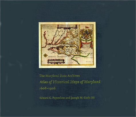
1. The Maryland State Archives Atlas of Historical Maps of Maryland, 1608-1908
by Edward C. Papenfuse, Joseph M. Coale III
Hardcover: 240 Pages (2003-05-20)
list price: US$76.00 -- used & new: US$38.76
(price subject to change: see help)
Asin: 0801872359
Canada | United Kingdom | Germany | France | Japan
Editorial Review

Product Description
Maryland presents cartographers with a formidable test of their skills: unusualnatural boundaries, border disputes, and in 1790 the gift of sixty-seven square miles for thecreation of the District of Columbia have given the state a distinctively irregular configuration.Since the early seventeenth century, generations of mapmakers have met this challenge withartistic imagination and a variety of cartographical techniques.

In The Maryland State Archives Atlas of Historical Maps of Maryland, 1608–1908, Edward C. Papenfuse and Joseph M. Coale III bring together in one volume the results of theseremarkable efforts, from Captain John Smith's 1608 detailed sketch of the region to the mapresulting from the Supreme Court's determination of the state's western border in 1908. Utilizingthe latest digital imaging and printing technology, the Atlas contains stunning, full-colorreproductions of more than 250 of the most significant historical maps from stateand federalarchives. This handsome and informative collection--a thoroughly updated and greatly expandedversion of the authors' landmark book, The Hammond-Harwood House Atlas of HistoricalMaps of Maryland (1982)--provides an in-depth history of mapmaking in Maryland andcharts the state's early settlement patterns. ... Read more


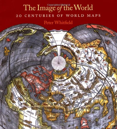
2. The Image of the World: 20 Centuries of World Maps / Updated Edition
by Peter Whitfield
Paperback: 160 Pages (2010-07-15)
list price: US$30.00 -- used & new: US$19.31
(price subject to change: see help)
Asin: 0712350896
Average Customer Review: 5.0 out of 5 stars
Canada | United Kingdom | Germany | France | Japan
Editorial Review

Product Description

Though technology has changed the tools of navigation available to us, maps are still the irreplaceable foundation of place and orientation. In this updated edition of Image of the World, map expert Peter Whitfield guides readers through a collection of some of the most extraordinary examples of maps—both visually stunning and historically revealing.

An enormous variety of maps from the last two thousand years are reproduced here in attractive, large-scale color illustrations. These fascinating and vibrant maps include Bishop Isidore of Seville’s first-century design for a circular world map, the elaborately decorated manuscript maps of the seventeenth and eighteenth centuries, and scientific maps of worlds that are still being explored, such as the ocean floor. In addition, Whitfield examines the history of world mapmaking through these outstanding individual examples. He discusses each map in relation to the religious, political, social or economic climates in which it was produced and considers what these maps reveal about the perceptions of their makers.

Image of the World returns to print a gorgeous and informative book that will appeal to map collectors, historians, and armchair explorers alike.

“Whitfield uses a wonderful selection of world maps to explain the flow of ideas through the ages.”—Time, on the first edition

... Read more

Customer Reviews (2)

5-0 out of 5 stars Lovely to Look At, Delightful to Read
I keep coming back to this book. Intelligent. Graced with beautiful design. Now if I only had unlimited income to spend on old maps.

5-0 out of 5 stars modern maps aren't always better
What a fetish we have made of accuracy and precision in maps! These maps--even the mediaevil ones showing the location of the Garden of Eden--are coherent world views. Many of the maps have been restored to their original look.
Hard to know where to draw the line between art, science, religion and history. Excellent text. ... Read more


3. Ancient Britain (Historical Map)
by Ordnance Survey
Map: Pages (2005-05-16)
list price: US$9.87 -- used & new: US$5.42
(price subject to change: see help)
Asin: 0319290352
Canada | United Kingdom | Germany | France | Japan
Editorial Review

Product Description
Historical Maps.Only two maps in this series, comprising Ancient Britain and Roman Britain.Produced in conjunction with the Royal Commissions on Historical Monuments for England, Scotland and Wales. ... Read more


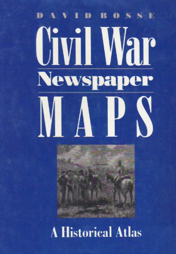
4. Civil War Newspaper Maps: A Historical Atlas
by Professor David Bosse
Hardcover: 176 Pages (1993-10-01)
list price: US$38.00 -- used & new: US$21.45
(price subject to change: see help)
Asin: 080184553X
Canada | United Kingdom | Germany | France | Japan
Editorial Review

Product Description

In Civil War Newspaper Maps, David Bosse shows how nineteenth-century advances in printing and engraving technology, coupled with an unprecedented public demand for information, led to the development of a means of mass communication still in use today--the quickly produced, up-to-the-minute newspaper battlefield map. Bosse's introduction offers a concise overview of the subject, including how correspondents got maps to their papers from the field, press-military relations during the war, and the economic problems of map printing. Following the text is an atlas of forty-five newspaper maps printed by the Northern daily press, each accompanied by a summary of the military operation it illustrates and a commentary on the map itself.

... Read more

5. Historical Atlas of California
by Derek Hayes
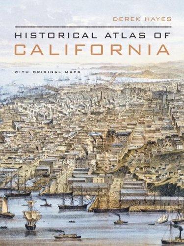
Hardcover: 256 Pages (2007-10-30)
list price: US$39.95 -- used & new: US$23.34
(price subject to change: see help)
Asin: 0520252586
Average Customer Review: 4.5 out of 5 stars
Canada | United Kingdom | Germany | France | Japan
Editorial Review

Product Description
Using nearly five hundred historical maps and many other illustrations--from rough sketches drawn in the field to commercial maps to beautifully rendered works of art--this lavishly illustrated volume is the first to tell the story of California's past from a unique visual perspective. Covering five hundred years of history, it offers a compelling and informative look at the transformation of the state from before European contact through the Gold Rush and up to the present. The maps are accompanied by a concise, engaging narrative and by extended captions that elucidate the stories and personalities behind their creation. At once a valuable reference and an exhilarating adventure through history, the Historical Atlas of California, featuring many rare and unusual maps, will be a treasured addition to any library. Distilling an enormous amount of information into one volume, it presents a fascinating chronicle of how California came to be what it is today.
Copub: Douglas & McIntyre ... Read more

Customer Reviews (8)

5-0 out of 5 stars Derek Hayes Map Book of California
It was great when it was talking about the history of California, from the time of Cortes. It had great explanations about each of its maps, and the maps showed the California culture, with the Spanish maps, and cartoons.

5-0 out of 5 stars A "must have" book for serious people
Hayes' "Historical Atlas of California" is a real treasure.
His book spans 500 years of the history of CA.
It is very readable and a "must have" for any student of historical geography. I strongly recommend it. It is well written and very well illustrated. A real find.
Anybody interested in California's past and future would be well advised to at least peruse this "coffee table" sized book.
It has a wealth of information and lots of rare maps.

4-0 out of 5 stars Cartographical cornucopia
This chronologically depicts California's discovery, development, and divisions. It follows the guesses of the earliest European explorers (I wonder what a native map would look like, but none's represented) and you see the island gradually become a peninsula or archipelago before assuming over the centuries its coastline. Then, the interior begins to take shape, and cities and farms and railroads fill the spaces. A sort of time-lapse ideologically and practically from the past five centuries.

You better understand the gaps: Virginia is shown a few days from California in one early attempt, while the Gold Rush pioneers used routes that were narrowly drawn and could not be deviated from-- around the rest of the West there might be empty spaces, figuratively or cartographically. San Francisco benefits especially throughout its growth, and a 1906 aerial drawing shows dramatically the fire sweeping some--but not all-- of The City. Hayes informs us in his text how the fatalities had been underreported (under 500) when they may have been three or even six thousand. The speculators and profiteers did not want to ruin their chances of rebuilding and selling to new residents. Such chicanery can also be found in the early Spanish who kept their findings off the maps, or kept the maps secret, to avoid tipping off discoveries to the rival British.

Not only rail and auto and industrial, but oil, military, and unusual maps appear. Those in which the patterns of Los Angeles 125 years ago can be found in the train routes, and how these mirror the freeways today, are instructive. I also learned that a 185-mile interurban line once ran from Chico to the Bay Area, to my great surprise. Among other finds: the color-coded charts directing the Japanese relocations during WWII, Jo Mora's Sierra cartoon (but his Hollywood one's not here), and a 1887 Hollywood real estate map from its first booster who, typically, showed many more mountains than even a pre-smoggy day could be glimpsed from Tinseltown-- let alone the beaches!

The text is informative, but I caught an error: Henry Kaiser's steel mill would have not been built at Fontana "eight miles inland" to avoid Japanese attack. Perhaps Hayes meant "eighty"? I do wish some of the maps were larger; the book's affordable and portable enough, but this invariably cuts down the ability even with magnification to discern the kinds of precision that any lover of maps likely has who'd buy this book.

5-0 out of 5 stars Highly recommended
I was delighted with the book. It is a treasure trove of information provided you use it properly. I use a magnifying glass to view the maps in close detail to get the most out of the book. If you look closely at the maps you are treated to an "evolution" of the state from the time that it was thought to be an island to the present. By inspecting each map very closely you see places that now don't exist, lakes that have disappeared, and roads that have gone from dirt paths to super highways. If you love history as I do, you'll love this book, I also recommend "the Historical Atlas of the United States" by the same author. Same format, same great look at the nation through time.

5-0 out of 5 stars Historical Atlas of California
This beautiful book contains copies of 476 historic maps dealing with California history from the earliest times to the present. This book is for any historian interested in California history, and any individual interested in maps. These are located in repositories all over the United States, thus we can virtually travel and update our history by reading this wonderful book. I was particularly delighted to find an 1847 rendering of the battle of Los Angeles between the Americans and the Mexicans. Each map is thoroughly cataloged in an appendix along with a fine bibliograhy. ... Read more


6. Strange Maps: An Atlas of Cartographic Curiosities
by Frank Jacobs
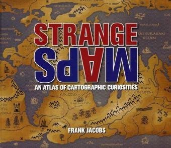
Paperback: 256 Pages (2009-10-29)
list price: US$30.00 -- used & new: US$16.02
(price subject to change: see help)
Asin: 0142005258
Average Customer Review: 4.5 out of 5 stars
Canada | United Kingdom | Germany | France | Japan
Editorial Review

Product Description
An intriguing collection of more than one hundred out-of-the-ordinary maps, blending art, history, and pop culture for a unique atlas of humanity

Spanning many centuries, all continents, and the realms of outer space and the imagination, this collection of 138 unique graphics combines beautiful full-color illustrations with quirky statistics and smart social commentary. The result is a distinctive illustrated guide to the world. Categories of cartographic curiosities include: • Literary Creations, featuring a map of Thomas More's Utopia and the world of George Orwell's 1984

• Cartographic Misconceptions, such as a lavish seventeenthcentury map depicting California as an island
• Political Parody, containing the "Jesusland map" and other humorous takes on voter profiles
• Whatchamacallit, including a map of the area codes for regions where the rapper Ludacris sings about having "hoes"
• Obscure Proposals, capturing Thomas Jefferson's vision for dividing the Northwest Territory into ten states with names such as Polypotamia and Assenisipia
• Fantastic Maps, with a depiction of what the globe might look like if the sea and land were inverted

The Strange Maps blog has been named by GeekDad Blog on Wired.com "one of the more unusual and unique sites seen on the Web that doesn't sell anything or promote an agenda" and it's currently ranked #423 on Technorati's Top 500 Blogs.

Brimming with trivia, deadpan humor, and idiosyncratic lore, Strange Maps is a fascinating tour of all things weird and wonderful in the world of cartography. ... Read more

Customer Reviews (7)

4-0 out of 5 stars Step Right Up! See the World's Smallest Kingdom Here!
This is a Wonder Book, a collection of "cartographic curiosities" in the words of the author. It is to a conventional atlas what side shows are to the big top. Here you'll find the misshapen and the misbegotten, the tallest man and world's smallest flame eater, the five-legged animals of the cartographic kingdom. Frank Jacobs, the author, an English journalist, knows his stuff and presents it with a knowing smile. There are eighteen tent shows (chapters) where you'll discover over 100 maps, each with a unique story.

The most charming series of maps in the book are The Aleph Maps, a series of 19th Century anthropomorphic depictions of twelve European nations: Denmark as a figure skater, Russia as a bear, Ireland as a peasant woman, etc.Created for children as a way of making geography interesting, they are colorful, flamboyant and captivating. The map of Oz, which shows the boundaries of the surrounding counties, would make a fine playroom poster. For history buffs, a political cartoon in the form of a Civil War period map showing General-in-Chief Winfield Scott's proposed campaign route to subdue the Confederacy, is a winner. Titled "Scott's Great Snake," the road from Maryland to Missouri is illustrated as a great snake and Scott's proposal became known as "The Anaconda Plan." President Lincoln didn't buy it. But, as you will see, he does have an island named for him in the South Pacific.

Jacobs' scholarship is on display in his selection and description of maps used to illustrate the novels of Jules Verne. These show up in the second tent, "Literary Creations," and involve, in addition to Lincoln's island, the imaginary country Verne called New Switzerland.Jacob's scholarship here more than equals that found in the description of New Switzerland in "The Dictionary of Imaginary Places" (Harcourt Brace, New York, 2000). (However, I credit The Dictionary for including a map of The Marvellous (sic) Land of Oz which marks the spot where Alice's house landed and shows you where to find Wise Acres and Rigmarole Town.)

Inevitably, some of the maps Jacobs' selected can not be reduced to fit the page without making their fine print difficult to read without a magnifying glass. And you may suspect he chose a few of the maps more to pad out the book than for their intrinsic interest, e.g. the beef stake cut to look like the map of Brazil. But you can't help but be fascinated by many of his selections including the metro system map that shows you how to get from Vancouver to Auckland on the train by way of Prague. For sure, Jacobs provides a way of looking at the world that puts far more in perspective than oceans and land masses.

5-0 out of 5 stars Just plain fun
This is a fun book just to breeze through and see everything from the ridiculous to the sublime.Some of the maps are exceptional, others are positively bizarre.Anyone who takes this book too seriously (like Julia) needs to get a life.....

5-0 out of 5 stars Humor abounds in a collection that uses cartography to point out ironies and inconsistencies in perception
STRANGE MAPS: AN ATLAS OF CARTOGRAPHIC CURIOSITIES spans centuries and the world in a unique map book blending color maps with quirky statistics, observations, and political as well as literary commentary. Humor abounds in a collection that uses cartography to point out ironies and inconsistencies in perception, making for a fine collection for any general library.

5-0 out of 5 stars What goes around comes around
Frank Jacobs's website has an honored icon on my Desktop; it's great fun to check what new and wonderful map he has come up with recently. All of his discoveries appeared first in print in a wide variety of publications, sometimes reprinted more than once. Jacobs then converts his map of the week to digital form and posts it on his website together with informative and amusing commentary.

This pretty little book collects some of his favorite maps and put them back into print again. As other reviewers have mentioned, the website is a living resource for anyone interested in maps. But it's very satisfying somehow to hold this book in the hand, partly to feel more in touch with the original version of the maps and partly to support Jacobs's efforts.

As an example of Jacobs point of view, this extract comes from a recent interview in "The New York Times":

"They say a picture is worth a thousand words. To rephrase that cartographically: a map is worth a thousand statistics. One of the best examples of cartography with a cause are Dr. John Snow's mid-19th-century cholera maps. His cartographic juxtaposition of cholera outbreaks and water sources showed the link between a contaminated water supply and the prevalence of the disease. By eliminating certain pumps, cholera cases were reduced dramatically. Dr Snow's research helped create the discipline of epidemiology. So yes, maps and the particular way in which they present information can be very influential indeed.

"Another stark example is Dr. Minard's map of Napoleon's ill-advised Russian campaign, also discussed in my book. It is a marvel of data presentation, combining six different sets of information. One of those is the size of Napoleon's army, represented by 1 millimeter for every 10,000 soldiers. The tiny trickle leaking out of Russia compared to the massive arrow going in is as horrifying an indictment as any of the madness and human cost of war."

If you have any interest in maps (or even if you don't and would like to understand why others might be), stop by the website or even better buy this fine book as well. It's one of those books you'll lend out time and again, assuming your friends ever return it.

Robert C. Ross 2009

4-0 out of 5 stars Good, but no replacement for the real thing
If you regularly read the Strange Maps blog and want to support Frank Jacobs with a few bucks, then this is the way to go. The book compiles the blog entries with nice large photos and un-cluttered text. However, if you're like I am, and like to look things up on the internet as you read about them, the experience of reading one of Frank's stories on the web is vastly different than reading it in a book. The book doesn't add anything to the content already on the web, and you miss out on the links to original sources and cross-references to other Strange Maps stories.If you or someone you know likes well-researched and engaging anecdotes about maps combined with the experience of reading such things in a book, then this one's for you. But if you just want to see some cartographic curiosities and pick up a factoid or two along the way, then perhaps the Strange Maps blog should be your first destination. Then you can decide whether it's worth is to shell out some money to have print copies of all the wonderful maps Frank has collected. ... Read more


7. Historical Maps of World War II Europe
by Michael Swift
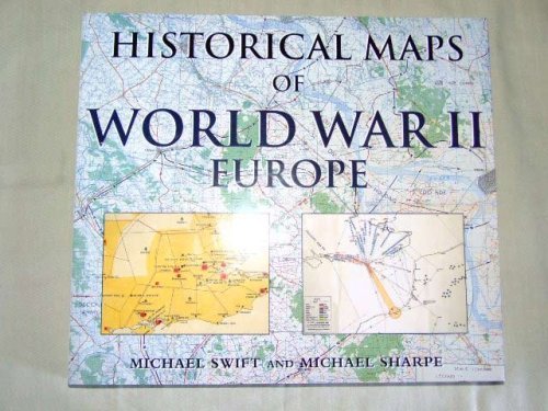
Hardcover: 144 Pages (2000-10-30)
-- used & new: US$10.00
(price subject to change: see help)
Asin: 1856485730
Average Customer Review: 3.5 out of 5 stars
Canada | United Kingdom | Germany | France | Japan

Customer Reviews (3)

3-0 out of 5 stars Unusual war maps
I would suggest this atlas would be most appreciated by the map collector who is looking for the unusual or interested in seeing what was used during the war.
The Index includes 85 maps that consists of action in North Africa, Europe and Russia. This atlas is not comprehensive covering every major engagement in the above theaters. The maps are selectively chosen and include maps for Tobruk, El Alamein, Kasserine Pass, Tunisia. For Europe they include the invasion of France in 1940 and include Sedan and the Maginot Line, Dunkirk, Calais, Boulogne. There are many maps of the Normandy landings, battles near Caen and later St Lo, Falaise, Operation Market-Garden, the Bulge, the crossing of the Rhine. Malta, Sicily and Italy are well covered and include Operation Husky, Salerno, Anzio beachheads, Monte Cassino. Eastern Europe has coverage as well and includes Bulgaria, Yugoslavia, Greece, Albania. Europe consumes 75 pct of those 85 maps.
In Russia, maps include the opening of Barbarossa, Paulus's advance on the Don bend at Kalach, the Crimea defense, the drive into the Caucasus
There are also maps of bombing targets in Northern Europe, the Bismark affair, convoy routes in the far north, the Dunkirk relief. Miscellanous maps include French Resistance centers, concentration camps, Peenemunde rocket sites and German Allied sectors after the war.

The quality of the maps vary. I broke them down into three categories: Marginal, Useful and Good. The ratio breaks down respectively as 19 pct, 41 pct and 40 pct. Marginal means the maps are either faded, so condensed or the labeling is so small as to have limited use. The maps that are Useful are better but still have minor viewing problems. The Good maps have no viewing problems and can easily be studied.

I would definitely suggest that this atlas should not be your only atlas but it does have curiosity value and would be appreciated by collectors or people with special interests that can't be found in other atlases.

4-0 out of 5 stars Not what I was looking for
This book has excellent military maps throughout every theater of World War II, but it wasn't what I was looking for. Some of the maps are small and hard to tell where you're looking, and I was hoping for several maps that showed shifting lines during different battles and such. Instead there is just one map for each conflict. Good book, but not what I had wanted.

3-0 out of 5 stars Historical Maps Yes!
Disappointingly few maps of anything other than the late war (most of the maps are 1943-1945).Some of the maps are in such fine detail that even with a magnifying glass it would be tough to see or read all the detail.Still this book has some wonderful treasures in it.Highlights for me are the French maps showing how little they knew of what Germany was sending against them and the one map of Bulgaria.Even though I would have liked a lot more maps on other aspects of the war, most every WWII student is likely to find at least several of the maps to be very interesting.For less than $5 this is a great reference. ... Read more


8. Magnificent Maps: Power, Propaganda and Art
by Peter Barber, Tom Harper
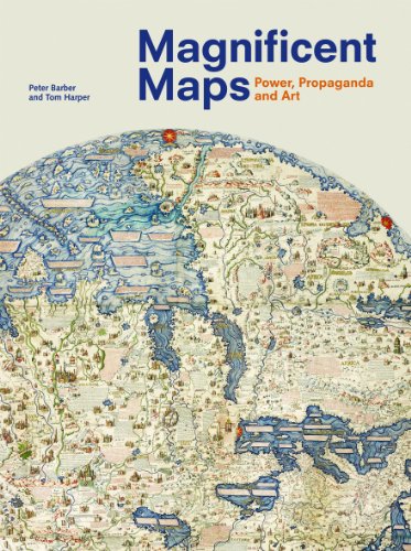
Hardcover: 176 Pages (2010-09-01)
list price: US$45.00 -- used & new: US$30.99
(price subject to change: see help)
Asin: 0712350926
Canada | United Kingdom | Germany | France | Japan
Editorial Review

Product Description

Maps are often as much a visual art form as they are a practical tool for navigation. Of particular visual interest are display maps—maps that often used size and beauty to convey messages of regional and social status and power. Despite their historical significance, many of these display maps have been lost and destroyed over time. Magnificent Maps brings together the best surviving examples in order to illustrate their role in early modern Europe and describe the settings in which they were displayed.

            Most of the maps collected in Magnificent Maps date from the period 1450 to 1800, the heyday of this approach to mapping. During their time, these maps were displayed in a range of settings, from palaces to schoolrooms to bedchambers, and Peter Barber and Tom Harper here offer vivid descriptions of their original settings and examine their dual roles as propaganda and art.

Drawn from one of the greatest collections in the world at the British Library, many of these maps will be completely new even to experts. The unusual aspect of cartography presented in Magnificent Maps will appeal to collectors, historians, mapmakers and users, as well as anyone curious about the many ways we have come to illustrate and define our world.

... Read more

9. Historical Maps of Europe
by Michael Swift
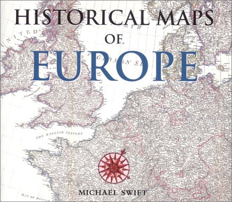
Hardcover: 144 Pages (2000-06)
list price: US$15.99 -- used & new: US$59.98
(price subject to change: see help)
Asin: 0785812164
Canada | United Kingdom | Germany | France | Japan
Editorial Review

Product Description
The maps in this book are reprinted from the collection held at the Public Records office in Kew, London.These superbly crafted charts, which have been accumulated from sources all over Europe over many years, are remarkable documents that until now have been accessible only to researchers.Dating from the earliest days of professional mapmaking, they chart over three centuries of European history through cartography.From the earliest representations of the mapmakers art in the 16th century, when the skills required to produce detailed scale maps first developed, to the elegant charts of the 19th century, they show the rise and fall of empires and the development of powerful nations.With an introduction that chronicles European history and detailed captions that explain the historical context of each of the maps, this is a fascinating work that is as insightful as it is attractive. ... Read more


10. Historical Maps of World War I
by Simon Forty
 Hardcover: 144 Pages (2004-08-28)
list price: US$9.98 -- used & new: US$10.00
(price subject to change: see help)
Asin: 1856487342
Canada | United Kingdom | Germany | France | Japan
Editorial Review

Product Description

These 125 rare and fascinating historical documents chart the boundaries of the Great War from its start in 1914 to the Armistice. Detailed maps show the trench lines of the major Western Front battlefields sitting side-by-side with Lawrence of Arabia’s campaigns in Palestine and the Middle East. Naval battles in the North Sea and Atlantic Ocean appear alongside details of ANZAC’s Gallipoli campaign or Canadian battles at Vimy Ridge. Plans for rolling barrages at Serre on the Somme contrast with details of operations in East Africa (the setting for the popular movie The African Queen). One section focuses entirely on the United States’ involvement in the fighting, while the introduction provides a brief background of the war and an examination of military mapping.
... Read more

11. West Cumbria (Cassini Old Series Historical Map)
by Ordnance Survey
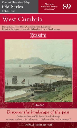
Map: 1 Pages (2006-11-06)
list price: US$12.71 -- used & new: US$7.77
(price subject to change: see help)
Asin: 1847360238
Canada | United Kingdom | Germany | France | Japan

12. Historical Atlas of the Pacific Northwest: Maps of Exploration and Discovery: British Columbia, Washington, Oregon, Alaska, Yukon
by Derek Hayes
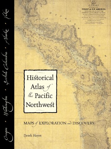
Hardcover: 208 Pages (2002-01-07)
list price: US$40.00 -- used & new: US$25.38
(price subject to change: see help)
Asin: 1570612153
Average Customer Review: 5.0 out of 5 stars
Canada | United Kingdom | Germany | France | Japan
Editorial Review

Product Description
A one-of-a-kind collection of maps created by the navigators, explorers, and cartographers who first charted the Northwest.

Representing four centuries of discovery and exploration, this unique reference book is a must-have for anyone interested in Northwest history. The Historical Atlas of the Pacific Northwest showcases more than 320 original maps, many never before published. Here are the maps of explorers such as Cook, Vancouver, Bodega y Quadra, Mackenzie, Thompson, and Lewis and Clark. Here too are maps created during boundary disputes, land purchases, the plotting of town sites, and surveys for railroads. Combined with historical background, these maps take the reader on an amazing visual journey through the discovery and development of the Northwest. ... Read more

Customer Reviews (4)

5-0 out of 5 stars Good overview!
I bought 3 books along the same topic as a gift for my husband. This was his preferred one.

5-0 out of 5 stars lots of original maps
Starting with pre-exploration theoretical maps through the Canadian Northern Railway's 1914 route map, this book gives a sampling of major mapping efforts in the Pacific Northwest (Alaska to Oregon). Maps of course reflect their makers, and this book reflects the range of interests over four centuries of Pacific Northwest explorations, in the two major waves of European marine explorers and settlers. The maps are reprints of originals, not made-for-the-book digests that I find so annoying. Each of the 320 maps is accompanied with a brief description of the map's provenance and the circumstances that make it important today.The book's format is large enough to peruse fine details, and there are some delightful accompanying illustrations in this beautiful book.

5-0 out of 5 stars A sense of place
The "Historical Atlas of the Pacific Northwest . . ." is an excellent read for anyone living in the Pacific Northwest from Coos Bay/North Bend to Nome, even if you aren't into maps.As someone who relocated here from the Midwest five years ago, this book has helped put the webbing between my toes.

The map research is impressive.Derek Hayes has reproduced maps in this book that I never would have known existed.The narative history is good reading as well (I detect the influence of Ken Burns here). The book has greatly increase my knowlege of the place I have chosen to live, both in terms of its history and the physical landscape.

I also recommend it to any history or geography buff, even if you mispronounce Oregon "Or E Gone!"

5-0 out of 5 stars Beautiful book of old maps and local history!
Ok, so I love maps and I live in the area, but this is still a rightly highly-acclaimed wonderful piece of work! Map fans will love it; locals will love it; others will learn (many) things from it. As well as the maps themselves, you also get a sweeping series of historical vignettes associated with each map. The least you'll get from it is the sheer joy of looking at a fantastic collection of wonderful old maps! ... Read more


13. Roman Britain (Historical Map)
by Ordnance Survey
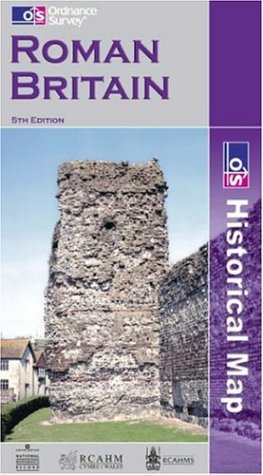
Map: Pages (2001-03-08)
list price: US$12.95 -- used & new: US$5.22
(price subject to change: see help)
Asin: 0319290298
Canada | United Kingdom | Germany | France | Japan
Editorial Review

Product Description
Historical Maps.Only two maps in this series, comprising Ancient Britain and Roman Britain.Produced in conjunction with the Royal Commissions on Historical Monuments for England, Scotland and Wales. ... Read more


14. The Penguin Historical Atlas of Ancient Egypt (Hist Atlas)
by Bill Manley
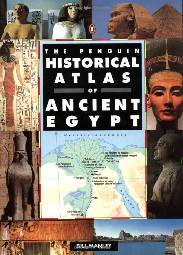
Paperback: 144 Pages (1997-01-01)
list price: US$18.00 -- used & new: US$10.37
(price subject to change: see help)
Asin: 0140513310
Average Customer Review: 3.5 out of 5 stars
Canada | United Kingdom | Germany | France | Japan
Editorial Review

Product Description
From its humble origins as a cluster of rival chiefdoms along the banks of the Nile, ancient Egypt rose to become one of the most advanced civilizations of its time. Noted Egyptologist Bill Manley traces its history from the founding of Memphis around 5000 B.C. Recent archaeological evidence sheds new light on the vast architectural legacy of one of the world's oldest nations. Full-color maps and b&w illus. ... Read more

Customer Reviews (9)

5-0 out of 5 stars Ancient Egyptian Atlas
A well-crafted and organized history of Ancient Egypt with excellent maps and descriptions of territories, kingdoms and movement of people and rulers throughout 7000 years of transformation.

1-0 out of 5 stars Unsatisfactory
The book has a great collection of maps; however, sidetracks from major aspects of Egyptian history. The information presented on the 25th Dynasty, is particularly unsatisfactory. Major events like the battle of 701 BC between Egypt's 25th Dynasty and Assyria, which changed map of the middle east, is vaguely mentioned. The information presented is inconsistent and certainly unsatisfactory for the average reader.

5-0 out of 5 stars Not the most informative book on Egyptian history, but then again it IS an ATLAS!
Many people are writing that this book did not satisfy their desire for facts and more in-depth explanations of Egyptian history, and that the book's text is not informative. This book is not meant for that purpose, and is really and truly an atlas. The maps are what matter.
In that reguard it serves its purpose and more. The maps are extremely easy to follow, clearly labelled and idenitified, colorful, and most of all- informative. One can tell so much about a period of history by analyzing a map, particularly several which have trade routes, battle sites, important roads and cultural sites CLEARLY marked. Who could ask for anything more! This atlas is wonderful, and is, I repeat, an atlas.
Anyways? What kind of person sits down and reads an atlas? I mean, seriously, its just a reference book, its not a novel. Its not supposed to tell wonderful stories and dazzle you with vibrant facts, its just maps, and anything else, is extra.

4-0 out of 5 stars Great aid to study of Ancient Egypt
Maps showing the changing boundaries of countries through a period of history are great visual for students of ancient history.

3-0 out of 5 stars Informative but dull
It is a good read for people with recent encountering with Egypt. But I was little appalled because information seemed dull. Book will give you facts and names but there isn't much more. Colorful images will attract your attention but I really believe those images have interesting legend and tales by their own. ... Read more


15. The Palgrave Concise Historical Atlas of Eastern Europe: Revised and Updated
by Dennis P. Hupchick, Harold E. Cox
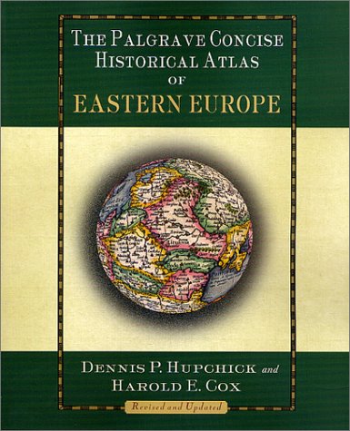
Paperback: 128 Pages (2001-09-22)
list price: US$21.95 -- used & new: US$7.95
(price subject to change: see help)
Asin: 0312239858
Average Customer Review: 3.5 out of 5 stars
Canada | United Kingdom | Germany | France | Japan
Editorial Review

Product Description
Thoroughly revised and updated, the new edition of this acclaimed and admirable (Booklist) resource explains key periods and events in the history of Poland, Hungary, the Czech Republic, Slovakia, the Baltic states, Ukraine, Russia, and rest of the former Soviet Union. ... Read more

Customer Reviews (6)

4-0 out of 5 stars Delivers the goods
I purchased this as a prelude to a tourist trip to Southeastern Europe -- territory that was behind the Iron Curtain during much of my life.It is also territory with a turbulent and confusing history, and many ethnic and religious rivalries.I found this Palgrave Historical Atlas to be at an ideal level to serve as an introduction to the geography, demographics, and history of this region, although I confess I remain overwhelmed by the details.Nevertheless, the text accompanying the many maps is generally well-written, and the maps are simplified and generalized to an appropriate degree to convey the territorial struggles and other spatial patterns without becoming overly confusing (all maps feature black & white lines with multiple shades of green used to portray areas of interest).As the authors state, boundaries were often fuzzy and shifting in this area where Muslims and Christians of various persuasions struggled for power and control at both local and regional scales.Indeed, a watershed struggle over Muslim / Christian dominance in Europe was played out on this Eastern margin, as it was in Spain and southwestern France in the West.The authors are to be complemented in maintaining a carefully neutral tone, while at the same time not stinting in their descriptions of the often arbitrary and ill-advised political and military decisions that have led to today's still somewhat unsettled national boundaries.

For the information of prospective purchasers, this atlas deals with the swath of Eastern Europe from Poland in the north through the current countries of The Czech Republic, Slovakia, and Hungary, to the Balkans and Greece in the south, plus Romania and Bulgaria on the coast of the Black Sea.Germany, Russia, and Turkey, all key external players, are only portrayed and discussed along their respective bordering lands.

4-0 out of 5 stars The ever-changing Eastern Europe
I bought this book along with the similar Palgrave Concise Historical Atlas of the Balkans. Although there is considerable overlap between the two volumes (since they're both by the same authors), there was enough of a difference for me to choose both.

I am intensely interested in Romanian history ... and this helped me to view many of the changes in this country over the ages ... as it (or pieces of it) were annexed by or lost to the many kingdoms and empires that ruled Romania's present-day territory.

3-0 out of 5 stars Nice attempt, but not good enough
* * * Do NOT buy hardcover version! * * *

Summary:
Maps: **
Text: ***(*)
Text-part to be used together with a different atlas. (e.g. "Historical Atlas of East Central Europe, by P. R. Magocsi or Cartographia's "Történelmi Világatlasz" (in Hungarian))

When I first discovered this atlas I thought: "At last a specific work on the topic in English!".
Well, despite the range of the maps - 52, listed at the end of the review - it was a disappointment.

First: As all ready pointed out bellow by fellow reviewers, the actual Eastern Europe - Russia, Belorussia, Ukraine - is only dealt with on the periphery.This is actually an atlas of East-Central Europe and the Balkans.
Second: The mentality of the text sometimes. "Nationalist", is one of the much preferred word used by the author, especially when dealing with newer history.The difference between "nationalism" and "patriotism" is apparently very subjective.
Third: The two first points could be something one could deal with - since a wrong title does not necessarily mean bad quality, and the book is aimed for US public - but now comes the greatest disadvantage about this work: The maps themselves.They can at best be described as of "average" quality, but words like "perfunctory" or "sloppy" could be used as well.There is no excuse for the roughness and distortion of state boundaries, the lack of rivers and cities/towns.And the actual errors to them have yet to be mentioned.

All in all, the map part of this atlas is suitable for very low-level studies of the area only, likely as a picture book for kids (and/or journalists) and the text for high-school studies. It must be mentioned that the author makes a honest attempt to be objective in the history telling, by sometimes presenting several versions/views on the same event, BUT I am sure that this still won't satisfy everybody.

A last remark: This volume shares 14 - or 1/3 - out of it's 52 maps with the "Historical Atlas of the Balkans" from the same series. (Nos. (4), 10, 16, 17, 18, 22, 24, 32, 36, 38, 39, 45, 46, 51 and 52, as observed by the author of these lines.)

The Maps:
1: Eastern Europe - Political, 2001
2: Eastern Europe - Physical
3: Eastern Europe - Demographic
4: Eastern Europe - Cultural
5: The Division of the Roman Empire, Late 3rd Century
6: The Barbarian Migrations, 4th-6th Centuries
7: The East Roman Empire under Justinian I, Mid-6th Century
8: Slavic and Turkic Invasions, 6th-8th Centuries
9: Eastern Europe, Mid-9th Century
10: The Rise of Bulgaria, 8th-10th Centuries
11: Constantinople, 10th-12th Centuries
12: The Balkans, Early 11th Century
13: The Rise of Hungary, 10th-13th Centuries
14: The Rise of Poland, 10th-13th Centuries
15: Eastern Europe, Mid-11th Century
16: The Balkans, Late 12th Century
17: The Latin Empire of Constantinople, 1214
18: The Rise of Serbia, 13th-14th Centuries
19: Eastern Europe, Mid-13th Century
20: Eastern Europe, Mis-14the Century
21: Prague, Mid-14th-15th Centuries
22: The Rise of the Ottoman Empire, 13th-15th Centuries
23: The Expansion of Poland, 14th-15th Centuries
24: Apex of the Ottoman Empire in Europe, Mid-16th Century
25: Istanbul, 16th-17th Century
26: Apex and Decline of Poland, 16th-17th Centuries
27: The Rise of the Habsburgs, 16th-17th Centuries
28: Ottoman Decline, 17th-18th Centuries
29: The Partitions of Poland, 1772-1795
30: Eastern Europe, 1809
31: Eastern Europe, 1815
32: The Balkans after the Serb and Greek Revolutions, 1830
33: Revolutions in the Austrian Empire, 1848-1849
34: The Austro-Hungarian Ausgleich, 1867
35: The Balkans, 1878-1885
36: The Macedonian Question
37: The Balkans, 1908
38: Bosnia-Hercegovina, 1908-1914
39: The Balkan Wars, 1912-1913
40: Eastern Europe, 1914
41: Eastern Europe During World War I
42: Eastern Europe, 1923
43: Independent Poland, 1920-1922
44: Hungary after Trianon, 1920-1939
45: Romania after Trianon, 1920-1938
46: The Transylvanian Question
47: Versailles-Created Yugoslavia, 1921-1941
48: Czechoslovakia and Munich, 1920-1939
49: Eastern Europe During World War II, 1938-1944
50: Eastern Europe, 1948-1991
51: Wars of Yugoslav Succession, 1991-1995
52: The Kosovo Crisis, 1999

Review based on First paperback September 2001 edition.

3-0 out of 5 stars Woe is the prolongation of the Cold War mentality
As the first new atlas of Eastern Europe of the new millenium, it is highly disappointing to see that this work has chosen to arbitrarily fix the eastern limits of Eastern Europe at the present-day eastern border of NATO, and leave out the "backward" lands of the former "evil empire". It is interesting to observe how people can at times discuss "European Russia" as ending at the Ural Mountains, but when it suits them feel no qualms about conveniently leaving this area out, because after all "nothing important goes on there anyway". This is just the perpetuation of long-held Western European biases about Eastern Europe (read "Slavs in the Eyes of the Occident" by Ciesla-Korytowska or "Infidels, Turks and Women: The South Slavs in the German Mind, Ca. 1400-1600" by Petkov for starters) which have been further reinforced by decades of the Cold War.

While Paul Robert Magocsi's excellent atlas also stopped short of including the eastern half of Eastern Europe (probably because he wanted us to buy his already-existing tome "Historical Atlas of Ukraine"), at least it was aptly titled "Historical Atlas of East Central Europe". This book's title is misleading to say the least.

One could make a case that the author wished to confine the coverage due to the complexity of the limited area he did cover. However, since the same author has also recently produced "The Palgrave Concise Historical Atlas of the Balkans", one wonders just how much more valuable this work is made by simply expanding the scope to include Poland, the Czech Republic, and Slovakia (and perhaps parts of Hungary and Romania?)

While a good job was done on the part of Eastern Europe covered, this book would have been twice as useful with the other half of Eastern Europe included as well. Thus people wanting to study the migrations of peoples such as the Hungarians and Bulgarians (or the Goths in the opposite direction), or invading threats to Europe such as the Avars or the Golden Horde will yet again be forced to buy two atlases and attempt to piece the picture together.

Also, what is believed to be the area of the formation of the Slavs lies across modern-day boundaries between Poland, Ukraine and Byelorus, and adequate coverage of this topic would seem impossible given the book's limitations.

It is unfortunate that despite all the progress made in the last decade, Europe can still not be seen in anything but terms of its recent political divisions. This cannot help but greatly impede our understanding of the past.

4-0 out of 5 stars Disregard nationalist lament below -- this book is great
The reviewer below is right that this book rather arbitrarily leaves out what most lay people consider the very heart of "Eastern Europe" (itself a subjective construct): that is, Russia, Belarus, Ukraine, et al. I can only assume the authors did this to make the "concise" element of their title right true. Still, to disregard the book because of this significant oversight would be a big mistake, for the terrain it does cover is done with remarkable clarity and, indeed, concision. The atlas is an invaluable companion to any reading about the Balkans or Eastern Europe up to the eastern border of Poland. Do not let our insulted nationalist convince you otherwise. ... Read more


16. Cartographica Extraordinaire: The Historical Map Transformed
by David Rumsey, Edith M. Punt
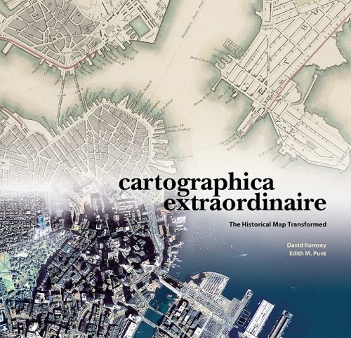
Hardcover: 200 Pages (2004-03)
list price: US$79.95 -- used & new: US$55.40
(price subject to change: see help)
Asin: 1589480449
Average Customer Review: 4.5 out of 5 stars
Canada | United Kingdom | Germany | France | Japan
Editorial Review

Product Description
David Rumsey's collection of historical maps is one of the largest and most complete of its kind. Focused for the most part on North and South America in the eighteenth and nineteenth centuries, the collection is comprised of more than 150,000 items: maps, atlases, and contextual supporting documents. Unlike similar collections, the delicacy and rarity of which necessitate careful storage and restricted use policies, The Rumsey Collection is available in its entirety on the Web and it is this conjunction of old and new technologies that is the heart of Cartographica Extraordinaire.

The maps selected for Cartographica Extraordinaire tell a hundred distinct, exciting, important, and sometimes controversial stories, along two main paths of inquiry: how did a continental wilderness become a civilization, and how has the development of cartographic science changed the ways we perceive, describe, study, and use that land?Geographic information systems have come, as part of the digital revolution, to dominate the cartography of today, but GIS didn't leap into being out of nowhere; all its processes and capabilities have precursors in historical maps. Old maps can therefore tell us not only the stories of their subject matter, but stories about the nature of mapmaking as well: its exigencies and limitations, trends and developments-its theory and practice and what that tells us about the people we were, are, and will be. ... Read more

Customer Reviews (6)

4-0 out of 5 stars Gorgeous.
David Rumsey, Cartographica Extraordinaire: The Historical Map Transformed (ESRI, 2004)

This massive coffee table book is all about maps (mostly of the United States, with a few from other parts of North America thrown in for good measure) and how they change over time, not only as people discover more about the world they live in, but as progress takes its toll, measuring tools improve, etc. Simply put, it's fascinating. Rumsey's stated goal, both with this book and with his website, is to bring historical maps back into prominence as tools to understand history and change, and this is certainly a fine start. The writing (there isn't much, but what there is is always on point) is engaging, the maps are fascinating, and the book itself is quite nicely put together; given its size, I'd have expected some binding defects or the like. A wonderful piece of work, worth every penny. I wish it had gone into a little greater detail in some of the framing text, but that's hardly something to quibble over in a project of this magnitude. ****

5-0 out of 5 stars map lovers, look out!
this is truly an extraordinary book, with excellent reproductions of all types of maps. the index provides the original map dimensions, which i found helpful. this book would be a great additional to any library, young or old.

5-0 out of 5 stars History Through Illuminating Maps
David Rumsey was fascinated by maps as a kid, and they were always papered onto the walls of his room.The fascination with maps did not leave him, through several degrees in fine art and a career in real estate.He amassed one of the largest private collections of maps, The David Rumsey Historical Map Collection, 150,000 catalogued items stored on the ground floor of his house in San Francisco, which is a working library for people to use.The items are wall maps, folding maps, globes, map puzzles, and many others.There is a sampling of the collection in _Cartographica Extraordinaire: The Historical Map Transformed_ (ESRI Press) by David Rumsey and Edith M. Punt, a slim but large-paged, handsome volume containing all kinds of maps concentrating on North America.They show the history of America, to be sure, but are also a history of mapmaking.Rumsey has painstakingly put items in his collection on the Internet, so he himself is participating in mapmaking history, and some pages of this beautiful book demonstrate what can be done with maps transformed into pixels.

Looking at these lovely maps is to participate a bit in Rumsey's enthusiasm, which one can pick up from his introduction: "A map, especially a historical map, ... communicates both above and below the narrow bands of language and observation."There are only a hundred and twenty or so maps selected here, but besides being beautiful objects to contemplate, they show an amazingly diverse range of ideas: how people explored coasts, or how train schedules were arranged before we had standard time zones, or how we claimed, organized, and sold the land.For those of us who only look at highway maps, there is an enormous education here.It is barely possible to mention the subjects of some of these maps; if this subject matter at all interests you, nothing will do except to get the book itself and look through the pages.For instance, the map by William Clark (of Lewis and Clark) of the trek across western America is here, but in a version issued by Rumsey in celebration of the 200th anniversary of their travels.It shows the original drawing, seamlessly enclosed within the General Land Survey's first map of the area, which is itself within a 1971 map of a US Geographic Survey National Atlas, which in turn is within a Landsat mosaic from NASA.The joins of the maps are seamless because they all were turned into computer data that could be massaged in just the right way, and because they are "georectified" to match up perfectly.This was hardest to do with Clark's 1814 map, which because of survey and navigation limitations of his time (not because of sloppy mapmaking) had accurate latitudes and distorted longitudes.

Rumsey's collection exists physically, of course, but access to the historical maps entailed the basic problem of "many hands taking hold of rare and delicate objects."Digital photography and computer storage have opened his collection for anyone who wants to look, and you don't even have to be there physically.He has found that magnified images of the maps can show details that were obscure even in the originals.Astonishingly, information compression has meant that a picture that originally required 400 megabytes can actually be stored in 3% of that size without loss of image quality.By digitizing his maps and making them available, Rumsey has himself stepped into cartographic history.This book is a demonstration in book form of what Geographic Information Systems can do, and Rumsey sees the "digital wizardry of GIS not as a break from the past and old mapping traditions," but part of those traditions.If you go to the website, you can look around anywhere; there is no guide._Cartographica Extraordinaire_, on the other hand, has the job of demonstrating the progress of history and of information display, and does both engagingly and handsomely.

5-0 out of 5 stars An outstanding and representative collection
The impressively collaborative work of David Rumsey (President of Cartography Associates, a San Francisco-based digital publishing company, and Director of Luna Imaging, a provider of enterprise software for online image collections) and Edith M. Punt (professional cartographer and recipient of the 1996 National Geographic Award in Cartography), Cartographica Extraordinaire: The Historical Map Transformed is a 160-page, hardcover, coffee-table book printed on archival paper which showcases how technology has literally transformed the restoration, re-creation and reproduction of historical maps. The specific focus is upon maps (and the people who made them) that reflect American history and ranges from a 1736 atlas depicting California as an island, to a Civil War era "bird's-eye" view of military positions on the southeastern seaboard. This is an outstanding and representative collection drawn from the David Rumsey Map Collection and illustrates early American history from a uniquely geographic perspective. With it's informed and informative text, Cartographica Extraordinaire is clearly recommended for inclusion into professional, academic and community library Cartography Studies or American History collections. Indeed, Cartographica Extraordinaire would make an excellent selection for a truly unique Library Memorial Fund acquisition.

5-0 out of 5 stars Not just extraordinary, it's amazing
At first sight, this is a gorgeous book. It exhibits historical maps made in nineteenth century America, and the reader might expect a reverential approach of the map collector that David Rumsey exemplifies. But David Rumsey is also the person who provides amazing open access to his collection through the highest tech web site. He sees maps not just as curiosities, but as a way to get inside the past. With Edith Punt, they have tied the maps into the social, environmental and technological changes that are shown. They use the most current geographic information systems technology to spark a connection to the current landscape. The old fragile maps come alive. While this book has the format and polish of your average coffee table book, this is a book to read and reread. ... Read more


17. Historical Maps of Ireland
by Michael Swift
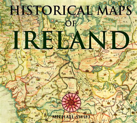
Hardcover: 144 Pages (1999-07-01)
list price: US$15.99 -- used & new: US$24.65
(price subject to change: see help)
Asin: 0785811095
Average Customer Review: 5.0 out of 5 stars
Canada | United Kingdom | Germany | France | Japan

Customer Reviews (1)

5-0 out of 5 stars Historical Maps of Ireland
This is a really good collection of colour reproductions of early maps of Ireland, taken from the English Public Record Office, and well organised. The best are the very early (16th & 17th century) ones, but there are also interesting later ones. The book has two flaws. The major one is that there are no PRO reference numbers, making it hard for anyone to go and search out the originals, the lesser one is that the introduction is a long historical essay about Ireland covering the last two thousand years. I don't see any need for this in a book of this sort, though the essay is, in itself, unobjectionable. ... Read more


18. MAPS OF GETTYSBURG, THE: An Atlas of the Gettysburg Campaign, June 3 - July 13, 1863 (FULL COLOR)
by Bradley Gottfried
Hardcover: 384 Pages (2010-06-01)
list price: US$39.95 -- used & new: US$21.55
(price subject to change: see help)
Asin: 1932714820
Average Customer Review: 4.5 out of 5 stars
Canada | United Kingdom | Germany | France | Japan
Editorial Review

Product Description
FULL COLOR Edition: After multiple editions and printings in just two years, the bestselling 'The Maps of Gettysburg' is available for the first time in a full-color, hardcover edition!

Thousands of books and articles have been written about Gettysburg, but the operation remains one of the most complex and difficult to understand. Bradley Gottfried's groundbreaking 'The Maps of Gettysburg: An Atlas of the Gettysburg Campaign, June 3 - July 13, 1863' is a unique and thorough study of this multifaceted campaign.

The 'Maps of Gettysburg' breaks down the entire operation into thirty map sets or "action-sections" enriched with 144 detailed, full-page color maps comprising the entire campaign. These cartographic originals bore down to the regimental and battery level and include the march to and from the battlefield and virtually every significant event in between. At least two-and as many as twenty-maps accompany each map set. Keyed to each piece of cartography is a full facing page of detailed text describing the units, personalities, movements, and combat (including quotes from eyewitnesses) depicted on the accompanying map, all of which makes the Gettysburg story come alive.

This presentation makes it easy for readers to quickly locate a map and text on virtually any portion of the campaign, from the march into Pennsylvania during June to the last Confederate withdrawal of troops across the Potomac River on July 13, 1863. Serious students of the battle will appreciate the extensive and authoritative endnotes and complete order of battle. They will also want to bring the book along on their trips to the battlefield.

Perfect for the easy chair or for stomping the hallowed ground of Gettysburg, 'The Maps of Gettysburg' is a seminal work that belongs on the bookshelf of every serious and casual student of the battle.

About the Author: Bradley M. Gottfried, Ph.D., is the President of the College of Southern Maryland. An avid Civil War historian, Dr. Gottfried is the author of five books, including 'Brigades of Gettysburg: The Union and Confederate Brigades at the Battle of Gettysburg' (2002). He is currently working with co-editor Theodore P. Savas on a Gettysburg Campaign encyclopedia. ... Read more

Customer Reviews (30)

5-0 out of 5 stars Essential for Understanding Gettysburg
I recently spent a day at Gettysburg with my son and my father. We hired a Gettysburg guide to take us over to explore the fighting that took place at Culp's Hill since many people don't focus on this important part of the battlefield. In preparation for our trip I ordered the revised color edition of The Maps of Gettysburg by Bradley Gottfried. In short order, I was able to understand the tactical importance of controlling this hill after reading the brief narratives and then eye-balling the troop movements displayed on the maps. If you want to quickly gain an understanding of what took place just about anywhere and during any given moment at Gettysburg then this book is indispensable. The well designed color maps are on the right facing page while the battle narrative is on the left facing page. I found this design very user friendly; especially since you don't have to flip through pages to find a map that matches the narrative [This is a pet-peeve of mine with too many poorly designed military history books]. The maps show unit movements down to regimental and battery level. This hard-back is well built and at about 384 pages it is hefty, so if you bring it out in the field, make sure you have some way to protect it. The book also has an Order of Battle and endnotes so sources can be tracked down if needed. This book is the best thing out there for serious battlefield students and those who want to decipher a complex three day battle.
John J. Fox III
author, The Confederate Alamo [2010],
Red Clay to Richmond [2004]
[...]

5-0 out of 5 stars Simply Outstanding.
This is quite simply, a must have book on the battle. It follows the same format as Dave Powell's _Maps of Chickamauga_, which I read and reviewed here earlier in the year. In fact, my great experience with Dave's book led directly to me purchasing this one.

The book includes 144 full color maps each facing a page of text explaining the action on the map. The book begins with Lee's decision to move his army North and has basically one map for each day until the armies join battle on 1 July. Once the battle starts the maps cover much smaller periods of time, sometimes as short as half of an hour, and show each regiment's (in some cases each company's!) position and movements on the field. After the battle, Lee's retreat, and Meade's cautious advance are covered until the last Confederate crossed the Potomac back into Virginia on 13 July.

The book is simply outstanding. The maps are beautifully detailed but never cluttered. The organization is chronological, so students can quickly find anything they're looking for. The narrative is clear and concise. The book has a one small shortcoming. In contrast to Powell's _Maps of Chickamauga_, the narrative of the Gettysburg campaign provided on the pages facing the map simply isn't detailed enough to serve as a comprehensive account of the campaign. While doing a very good job of explaining the action on the map, the detailed information about the personalities involved and the motivations for their actions is somewhat limited. Even with this small gripe, the book is an indispensable resource for studying the campaign. Keep this book handy while reading Coddington's _The Gettysburg Campaign_, and you will have an excellent understanding of the battle

5-0 out of 5 stars Perfect Companion For Following Units Throughout the Battlefield
I purchased this book to take with me on a battlefield tour and found it to be second-to-none in its assistance in helping to track each unit throughout its activities and engagements over the three-day battle. On this trip I focused on the Day 1 movements and engagements and was able to stand on the same ground as many of the units in which I had a particular historical interest. I was thrown off on one a few occasions when I could not find the 107th PA on any of the maps eventhough it was listed in the narratives. I discovered it was consistently mislabeld at the 107th NY on the maps. The author may want to correct in future editions if he has not already. All-in-all a great battlefield companion guide.

4-0 out of 5 stars When is the book coming
The description says the book to released April 19, 2010, but Amazon says they will ship in one to three months. One of these needs to be updated.

5-0 out of 5 stars Get the Details
I am by no means an expert on the battle of Gettysburg but I can say this book is the first I have read on the battle that gave me a feel for what happened at the lower brigade and battalion levels.The book combines detailed order of battle, a clear discussion of maneuver, personal accounts from private through general, and over 120 maps in a way which allows you to really start to appreciate that there is much more to the battle than "Pickett's Charge" (Or Pickett - Pettigrew - Trimble Charge" as it is called in the book.

The format of having the text and maps facing each other is very useful as it allows one to trace the battle on the map as you read the text.While the text is very readable, I found the book a self-imposed "slow read" as I could not help but jump between the narrative and the map or turn the pages to compare prior or follow-on maps to get a better understanding of each engagement.

Living within an hour of Gettysburg, I look forward to using this book to help me walk places like The Wheatfield, The Peach Orchard and that long walk between Seminary and Cemetery Ridges. ... Read more


19. Historical Maps of the Napoleonic Wars
by Simon Forty
Hardcover: 144 Pages (2004-07)
list price: US$9.98 -- used & new: US$14.95
(price subject to change: see help)
Asin: 1856487334
Canada | United Kingdom | Germany | France | Japan
Editorial Review

Product Description
“A wonderful collection.”—Library Journal

Based on the unique collection at the Public Record Office in Kew, England, this amazing assortment of more than 100 military maps charts the Napoleonic conflict from its start in 1803 to the defeat at Waterloo in 1815. Each one is beautifully hand drawn, accompanied by a caption explaining its significance. The maps reveal in fascinating detail how the events were plotted out, including the major battles at Trafalgar and Austerlitz. Follow the fighting and clashes on every front, including Germany, Russia, and Austria in the east, and the crucial encounters in Belgium. Simon Forty, a highly praised military writer, presents a concise history of both the war and military mapping. An essential compilation.
... Read more


20. The 1858 Map of Cape Cod, Martha's Vineyard, & Nantucket (Travel Maps Atlases)
Hardcover: 132 Pages (2009-11-15)
list price: US$50.00 -- used & new: US$31.39
(price subject to change: see help)
Asin: 0978576675
Average Customer Review: 5.0 out of 5 stars
Canada | United Kingdom | Germany | France | Japan
Editorial Review

Product Description

Based on the five-foot by five-foot 1858 Map of the Counties of Barnstable, Dukes, and Nantucket Counties by Henry F. Walling, this display-style book showcases each county, town, village, and the major bodies of water that surround and connect them. It includes each home and business, road by road, complete with the names of property owners and important geographic features, as well as useful tables of statistics and delightful period illustrations. Originally produced at the end of the Great Age of Sail, at a time when whaling and salt-making were still strong industries in the region, this gorgeous wall map depicts Cape Cod, Martha's Vineyard, and Nantucket at an industrial apex. By publishing the map in book form, by including commentary from some of the region's most insightful writers and scholars, and by utilizing photographs of three different originals, the publishers and designers are able to enlarge and showcase each portion of the map on separate pages and page spreads. The result is that readers are able to view and understand 19th-century Cape Cod and the Islands with a level of detail that is nothing short of celebratory.
... Read more

Customer Reviews (2)

5-0 out of 5 stars The 1858 Map of Cape Cod, Martha's Vineyard, & Nantucket
The book was purchased for friends.They are a married couple, both with deep roots in Cape Cod.They are delighted with the book and hope to find home sites of ancestors.I have seen the book and was pleased with the photography and page layouts.Also of value was the informative writing of Jim Coogan.

5-0 out of 5 stars The 1858 Map of Cape Cod, Martha's vineyard & Nantucket
The book they we purchased was really nice. It was a gift for my father-in-law. He liked it a lot. My husband and his father have been looking at the maps. to see how things were in the 1800's. My in-laws have a second home on the cape and it been fun looking at the diferent places and how they have changed over the years.We are glad that it we were able to make the purchase. It was a great Xmas present for him. ... Read more


  1-20 of 100 | Next 20
A  B  C  D  E  F  G  H  I  J  K  L  M  N  O  P  Q  R  S  T  U  V  W  X  Y  Z  

Prices listed on this site are subject to change without notice.
Questions on ordering or shipping? click here for help.

site stats